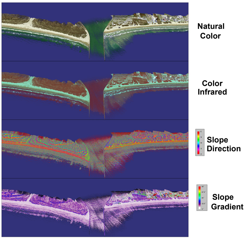
Availability of highly accurate and spatially as well as spectrally dense topographic data provided us with myriad opportunities for advancing our understanding of how the coastal environment has evolved over time, as well as predicting its future evolution in the event of large magnitude storms (such as hurricanes) or human-made disasters such as oil spills. This presentation will address the applications of a series of algorithms that were developed for 3D visualization morphological change analysis of dynamic coastal environments using point cloud data and image fusion techniques. Tools developed as part of this investigation will be used to address shoreline erosion, beach-dune sediment budget, status and trends of aquatic habitats, and restoration of beaches, dunes, and wetlands along the Gulf Coast shorelines. The tools will allow any users to run GEOID model and bias correction on raw point cloud data as well as to convert ASCII point cloud data into LAS 1.3 format and its conversion to seamless raster grid with user-defined variable cell size. These programs will also integrate X, Y, Z values of lidar point cloud data with RGB values of imagery, which could be a useful tool for visualization and morphological change analysis. It will also allow users to convert LAS format point cloud data into other data formats such as KML, VRML, and OSG, thus allowing any user to visualize/analyze the data on any computer (Windows, Apple, and Linux), using free visualization software as Google Earth, OpenSceneGraph, Terrain Viewer, VrmlView, Qsplat etc. Practical application of these tools will be demonstrated using examples from the Gulf Coast.