Groundwater Level Changes in Oklahoma and Texas in KMZ format
Research by Dr. Jadwiga (Jad) R. Ziolkowska and Reuben Reyes
The University of Oklahoma
This page provides supplemental information for this paper:
Groundwater Level Changes due to Extreme Weather -
An Evaluation Tool
for Sustainable Water Management
The dataset assoiated with this paper is
OK_TX_wells_Palmer2003_2014v5.kmz
has been tested with
Google Earth, NASA WorldWind, ArcGIS Explorer, and ArcGIS Earth.
You will need Google Earth or some other virtual globe to view this KMZ file.
We recommend using Google Earth if you dont have it installed here is a link:
Click here for link to Google Earth for download and installation.
Click here to download OK_TX_wells_Palmer2003_2014v5.kmz
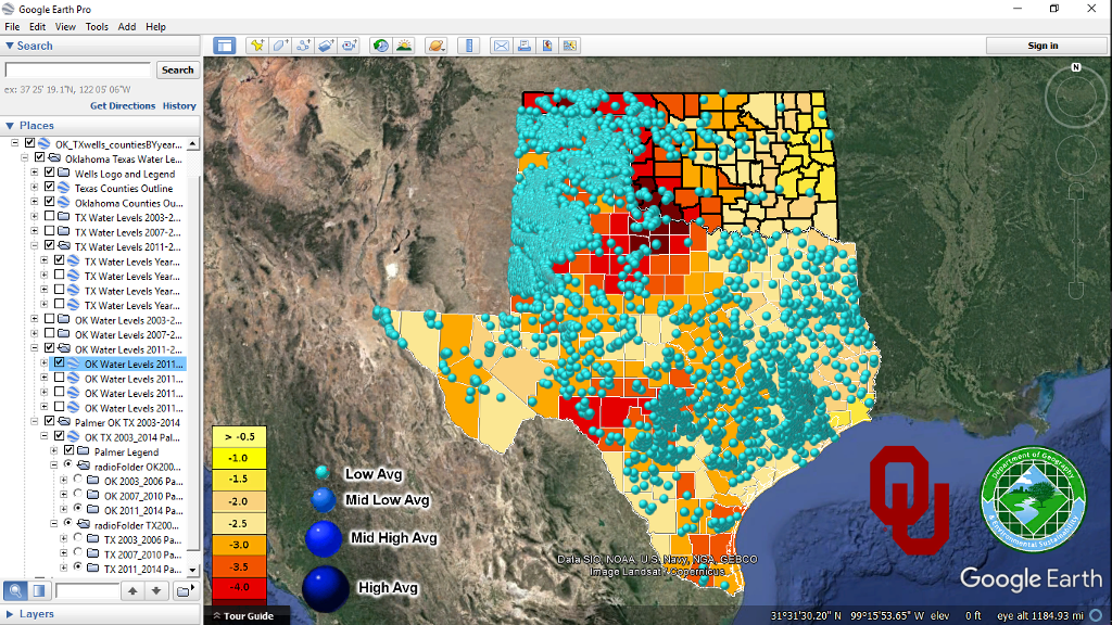
Below are 5 views after loading data set OK_TX_wells_Palmer2003_2014v5.kmz
Take note of left side check boxes and radioFolder selections.
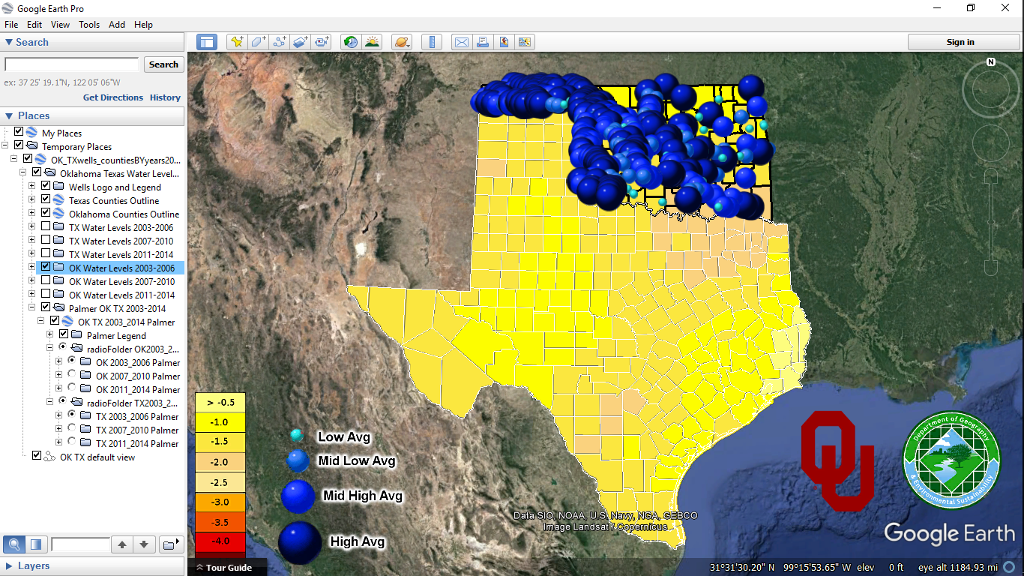
Oklahoma only 2003 to 2006 all groundwater levels.
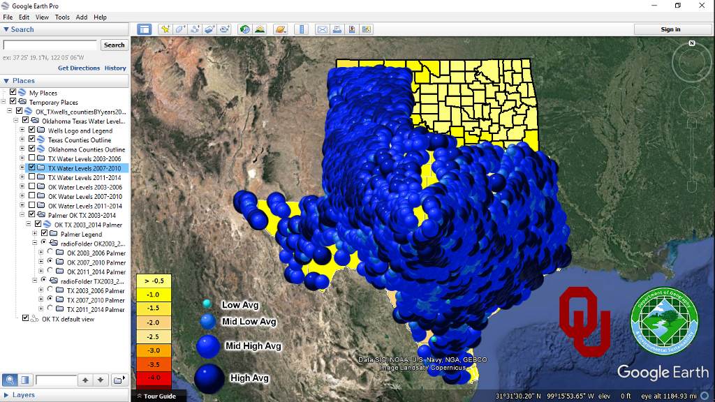
Texas only 2007 to 2010 all groundwater levels.
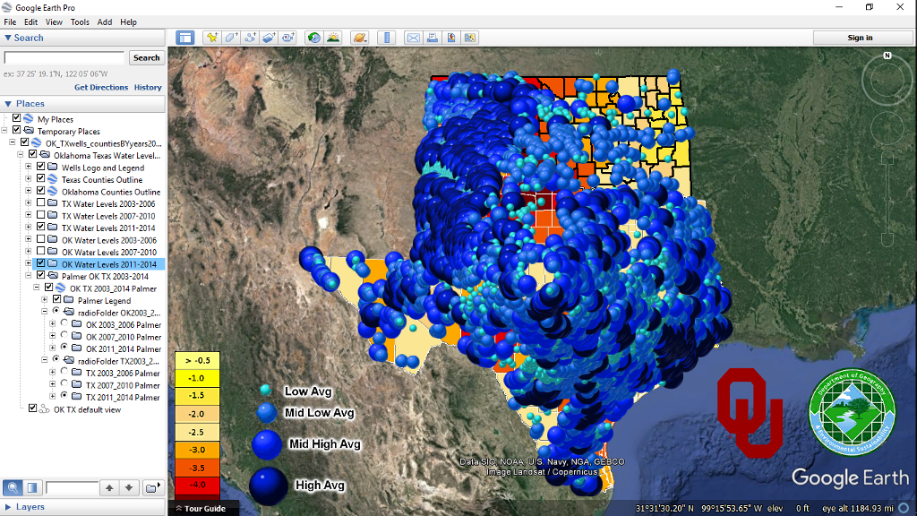
Oklahoma and Texas 2011 to 2014 all groundwater levels.
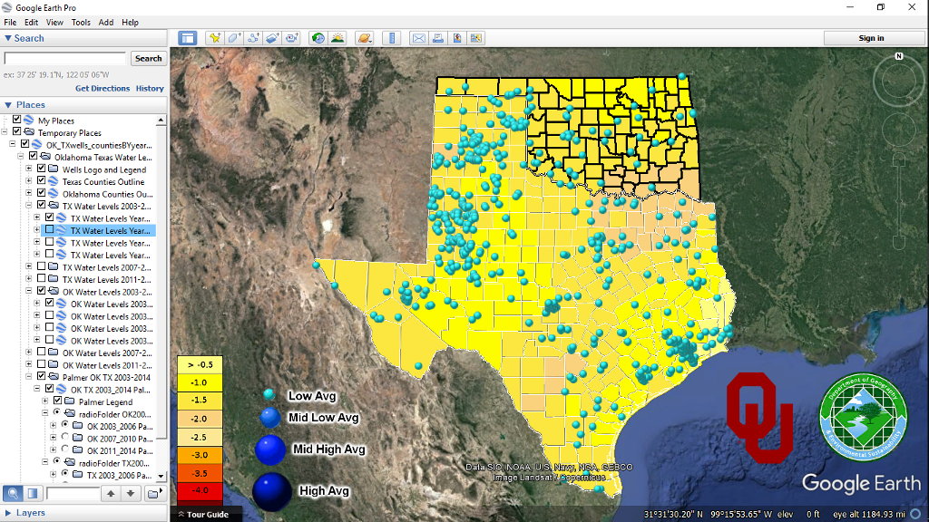
Oklahoma & Texas 2003 to 2006 low groundwater levels only.
Oklahoma & Texas 2011 to 2014 low groundwater levels only.
Cesium Showcase A Interactive Representation of Texas Groundwater Levels Over Time